|
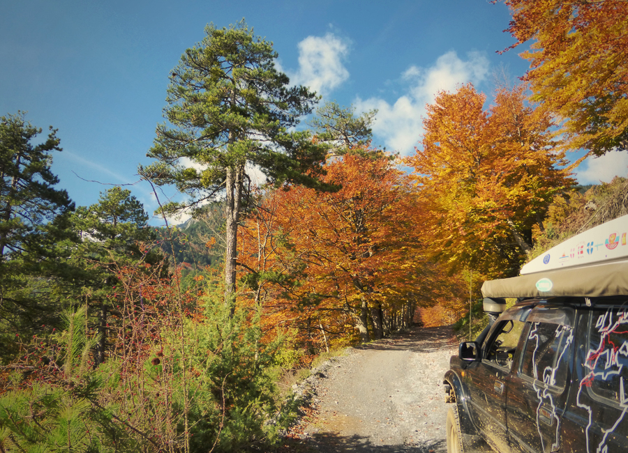
Greece is a huge country criss-crossed with a gravel road network of unpaved tracks covering 75,603km. 4x4 is by far the best way to discover some of its outstanding beauty and with a little planning you can hunker down behind the wheel and pretty much cross its entirety without using a paved road. This network of roads is in constant need of repair and in the mountains landslides are common. Most of the driving is fairly moderate and unlikely to push your skills (or vehicle) to the limit. The occasional unexpected rainstorm can make conditions more challenging (fun) but generally most routes are drivable throughout the whole year (with the exception of some mountain areas). The main reason for taking these routes is not solely for the driving, with just 11 million (compared to 64 million in the UK) people living in Greece you can experience some exceptional wild areas in relative solitude. Shamefully, new roads continue to be constructed with no respect for the natural environment. Our first experience of Greece green-laning was a route from Arta to the Meteora, the main stretch of which followed the Acheloos River valley South-east of Mount Tzoumerka. Just like the other mountains of the Pindus range, the area is home to rare mammals like bears and wolves - although they tend to keep safe distances from human intruders. Sadly nearly 80 years after it was first proposed, the massively controversial greater Acheloos diversion scheme is well under way and has pretty much ruined the natural beauty of the area. Firs, black pines, maples and other trees envelop the road creating a riotous canopy of reds, yellows and greens; thankfully obscuring the atrocity of the river diversion scheme. Our next off-road route looked like a scenic two-hour diversion on our rather ineffective 1:425.000 scale map. From the small village of Pouri, just north of Mount Pelion, we would take the ‘scenic’ green route down to the coast then head west towards Kerasia, just 16km away. Having tried two alternative trails and deciding they were not ‘the one’ marked on our ‘map’ we stopped at the head of a third to ask for directions (N39°28’59.525” E23°5’50.226”). With our token gesture of a map in hand and some pretty flamboyant gesticulating we questioned two old locals if we could get through to Kerasia. In typically Greek style they entered into an animated debate before offering a relatively convoluted answer. We think the gist of which was that we could but the road was so bad we shouldn’t – we pointed at Bee-bee and shrugged our shoulders, at which point, they both shrugged their shoulders and walked off. Kerasia was only 16km away, if the road was too bad or blocked we’d just turnaround and drive back, right? Two days later we emerged in Kerasia, muddied, tired, low on fuel but buzzing from our off-course off-roading. Our two-day adventure began when we decided to ignore the advice of the locals and drove off downhill towards the coast. The track was rutted and well used. We passed a few local working 4x4’s coming the other direction, the drivers all smiled politely and waved back at us as we pulled over to let them pass. After a slow winding 600m descent with some stunning views we arrived at sea level at a tiny fishing bay (N39°30’23.725” E23°4’47.385”). An immaculate little fisherman’s church on the bank of a small river poignantly marked the end of the well-used track and offered a potential safe haven to travellers wishing to venture beyond. We stopped for an opportune picnic before continuing into the unknown. The track continued up the other side of the valley and from this point became muddier, rougher and at times much steeper than we had experienced on our descent. Thankfully the ominous black clouds held off until we reached the summit. After a fairly slow 950m ascent, using instinct and a compass at every junction, we found ourselves at the top of a wooded plateau on the northern part of the Pelion Range. Once we’d reached the highland it became apparently clear that the tracks here were used by logging trucks, unfortunately the heavy traffic (weight not frequency) meant the tracks were much muddier. After 5 hours driving, the afternoon turned to evening and it became apparent we weren’t going to make it to Kerasia before nightfall. We found a clearing in the woods and set up camp. Two hours after we’d gone to bed we were woken by two cars approaching through the forest. Two 4x4’s pulled up alongside our camp and a Greek family of 7 promptly exited the vehicles and approached our camp. Much to our surprise, it turns out we were not the only ones who were lost on the mountain. The family were attempting to complete the same journey as us but in the opposite direction. We exchanged information about the road ahead; we were relieved to discover Kerasia was just 2 hours away.
In a twist of irony we told the family the same advice we received at the start of our journey; you could get through but the road was so bad you probably shouldn’t, we also told them Pouri was about 5 hours away… They shrugged their shoulders in disbelief and carried on regardless. At sunrise our dark, foggy camp became a beautiful, autumnal woodland haven. We set off and completed the last few muddy miles, re-joining the tarmac for a spectacular descent from the mountains and back to the coast.
0 Comments
Your comment will be posted after it is approved.
Leave a Reply. |
Archives
July 2020
Categories
All
|
Proudly powered by Weebly


 RSS Feed